

UPD Department of Geography News and Events
17 October 2013
08 October 2013
[ARANGKADA@30] Grand Alumni Homecoming

Dear Geography Alumni,
Warm greetings from your esteemed Department!
Being a graduate of the only Geography Department in
the country, you are one of those who continue to bring significant
contributions to our discipline and to other related fields, whether you are
directly practicing geography or indirectly using your geographic training to be
where you are now. What you have accomplished is in large measure responsible
for the growth and development of our institution.
We are happy to inform you that our Department will celebrate
30 years of being part of the College of Social Sciences and Philosophy this
November 2013 and will be holding a grand celebration to mark this milestone in
our existence. With the goal of strengthening alumni relations, the Department
would like to invite you to attend in our Grand Alumni Homecoming on November
30, 2013 at AS Lobby, Palma Hall at 6PM. You may find other details at Facebook events page or at our department website.
You can also become part of the alumni homecoming by providing
financial support. Your contributions will not only help in making the event
successful but also in augmenting the Department’s resources for its programs and
services. Your support will go a long way in strengthening our efforts at
achieving academic excellence and professionalism and eventually reaching our
goal of becoming the country’s Center of Development in the field of geography. For your contributions you may contact me or Ms. Rocelyn De Vera at rocelyndevera@yahoo.com. Sponsors will be entitled a space in the Homecoming's souvenir program (see details below).
We appreciate your support and honor your continued
involvement with your geography family of faculty, students, staff, and alumni.
We look forward to seeing you in the alumni homecoming!
DARLENE J. OCCEÑA-GUTIERREZ, Ph.D.
CHAIR
darlene.gutierrez@upd.edu.ph
djogutierrez@gmail.com
 |
| Click to enlarge |
27 September 2013
[IN THE NEWS] Visiting professor's traffic solutions in Michael Tan's Inquirer column

Last September 24,
2013, Visiting Professor Dr. Yves Boquet had a lecture entitled, Alongside
EDSA: Improving Metro Manila’s Transportation System & its Efficiency Using
Experiences of other Asian Megacities (A Geographer’s Perspective). Fortunately, CSSP Dean Michael Tan graced the
event and even featured Dr. Boquet’s recommended traffic solutions in his Pinoy Kasi - Philippine Daily Inquirer column. Read the article
HERE.
You can view the pictures taken from the lecture HERE.
Abstract of Dr. Boquet's Lecture: Alongside EDSA: Improving Metro Manila’s Transportation System & its Efficiency Using Experiences of other Asian Megacities (A Geographer’s Perspective)
20 September 2013
[LECTURE] Alongside EDSA: Improving Metro Manila’s Transportation System & its Efficiency Using Experiences of other Asian Megacities (A Geographer’s Perspective)

The UP Department of Geography invites everyone to a lecture:
Alongside EDSA: Improving Metro Manila’s Transportation System & its Efficiency Using Experiences of other Asian Megacities
(A Geographer’s Perspective)
by Dr. Yves Boquet
24 September 2013
1-4PM at Palma Hall Room 207
ABSTRACT
Metro Manila’s traffic is notoriously heavy and seems very wild and chaotic to Western eyes. Behind the apparent chaos appear some logics of a transport system aiming at transporting millions of people every day. EDSA exemplifies the problems of congestion across the Metro Manila area, from traffic jams to overcrowded urban rail transport and inadequate pedestrian facilities.
The situation seems to get worse over time; however there are some possibilities to improve it. I will comment on some of the recent policies concerning buses around Metro Manila and examine some “success stories” of transport policies and planning in other Asian megacities (Hong Kong, Guangzhou, Singapore, Osaka, Seoul…) that may be relevant to the Philippine case.
ABOUT THE LECTURER
Dr. Boquet is currently a Visiting Professor of the Department. He comes from the Université de Bourgogne (University of Burgundy) in Dijon, Francea as a professor of Geography. Since 2009 he has served as a
Secretary of the International Geographical Union (IGU) - Commission on
Transport and Geography.
16 September 2013
[ARANGKADA@30] A-RUN-KADA: Geography Fun Run 2013

Last September 14, 2013, the A-RUN-KADA: Geography Fun Run 2013 was successfully carried out amid heavy downpour. The event was attended not only by students but also by alumni of the Department and running enthusiasts. Out of the 189 registered runners, 161 competed in all the three events: 2.2 km, 4.4 km, and 8.8km. The following are the winners in each category and event:
| 8.8km | MALE | FEMALE |
|---|---|---|
| 1st Place | Kimbert Sarmiento | Janette Lumidao |
| 2nd Place | Raul Benjamin Mendoza | Chai Abundo |
| 3rd Place | Loren Gal |
| 4.4km | MALE | FEMALE |
|---|---|---|
| 1st Place | Wilson Maningkil | Mary Grace Parcon |
| 2nd Place | Lowemer Estrella | Saki Niiyama |
| 3rd Place | Alain San Miguel | Acer Jian Figueroa |
| 2.2km | MALE | FEMALE |
|---|---|---|
| 1st Place | John Michael Marfil | Maria Alexandria Kundert |
| 2nd Place | Noel Ricamunda | Inna Valera |
| 3rd Place | Mark Jefferson | Maria Deandra Andal |
The program during the fun run was hosted by Prof. Ony Martinez and Alumni Mr. Jayson Cruz and a performance was rendered by the percussion group White Tazandra. Aside from the cooperation of the students, faculty, and staff who made the event possible, the Department recognizes the efforts of Mr. Willy Domingo who acted as guide and marshal of the fun run.
A-RUN-KADA: Geography Fun Run is part of the 30th anniversary celebration of the Department of Geography under the College of Social Sciences and Philosophy.
03 September 2013
[ARANGKADA@30] Colloquia on Spatial Technologies in Advancing Research Techniques

Everyone is invited to
The Geography Lab Core Group Technical
Colloquia’s
Spatial Technologies in Advancing
Research Techniques (START)
Date: September 12, 2013
Time: 5:30-7:30pm
Venue:
Palma Hall 207, Roxas Avenue, UP Diliman, Quezon City
Topics:
Session 1: Modeling Geographic
Distributions with MaxEnt
Discussant: Mart Geronia, MS Geology
student
MaxEnt (Maximum Entropy) is a java-based
free software that is capable of producing ecological models of the geographic
distributions of species based on variables using the maximum entropy method of
probability. The maximum entropy method ensures that the probability
distribution the model estimates is closest to uniform and the most spread out,
subject to the constraints set by the variables; i.e., the model assumes that a
species can be found uniformly across space subject to the constraints set.
This software is written by Steven Phillips, Miro Dudik and Rob Schapire, with
support from AT&T Labs-Research, Princeton University, and the Center for
Biodiversity and Conservation, American Museum of Natural History. This
software generates models of a species’ geographic distribution using the
constraint features or the environmental variables describing the background landscape
and by using the collection of presence-only data of the distribution of the
species in question. It can also integrate both categorical and continuous data
for the variables and will not diminish its capability to produce a good model.
Aside from its application in modeling
the geographic distributions of species habitats in ecology and biogeography,
the maximum entropy method has been used in the fields of linguistics (for
natural language processing), economics (mainly in game theory), climate research
(modeling a species habitat based on future climatic scenarios), and in political
science and sociology (application of ecological inferences or drawing
conclusions about individual behavior from aggregate data).
Session 2: Grid Analysis and Display
System (GrADS) for Earth Science Data Processing and Visualization
Discussant: Robert Badrina, MS
Meteorology student
Grid analysis and display system (GrADS)
is an open source, interactive desktop tool that is used for easy access,
manipulation and visualization of earth science data. It can handle various
data file format such as binary (stream or sequential), GRID, NetCDF, HDF and
BUFR (for station data). GrADS has been implemented worldwide and currently
being used by researchers around the globe, it has an online group forum where
community of users exchange information about the software.
Outputs of climate models (Regional
Climate Model (RegCM) and Global Climate Model) are
can be utilized using GrADS. It uses
four convention environmental dimensions: longitude,
latitude, vertical level and time. There
are also data available for free such as resources
from the Tropical Rainfall Measuring
Mission (TRMM) which can provide rainfall estimates
that can be processed using GrADS. Data
can be displayed using variety of graphical
technique: line and bar graphs, scatter
plots, smoothed contours, shaded contours,
streamlines, wind vectors, grid boxes,
shaded boxes and station model plots. GrADS is
supported by the Institute of Global
Environment and Society dedicated for climate research
in the service of the society.
S.T.A.R.T. aims to provide a venue for
young researchers to present various techniques for visualizing and analyzing
spatial data using recent technologies and data processing software to aid in further
enhancing social science research methodologies.
As spatial information is integral in
addressing the pressing environmental and social issues we deal with at both
local and global scales, these colloquia seek to facilitate exchanges among young
academics on the potentials of available technologies to deliver useful
information to the public for more informed decision-making.
The Lab Core Group of the UP Department
of Geography was formed in 2009 by student
volunteers who wanted to help manage the
then small GIS laboratory of the institution.
Beyond serving as the lab technical
assistance team, it initiated other projects such as the Geography1 Open Lab which rovided
introductory training on Google Earth image interpretation, GIS, and GPS, and
the drafting of he GIS laboratory user guidelines and its file management and
data security scheme.
30 August 2013
[ARANGKADA@30] Rummage Sale

To fund our upcoming anniversary activities,we are going to have a rummage sale on September 15, 2013, 7:30am-6:30pm, at the Infirmary Open Area (UP Health Service), UP Diliman Campus.
You can join us in three ways:
One, donate items to the Department to be included in the rummage sale. Just bring them to the Department Office at 4th floor Bulwagang Silangang Palma;
Two, buy items from the rummage sale;
Or do both!
For inquiries call Ms. Ever at 9818500 local 2222 or email us at up.geography@yahoo.com
21 August 2013
GIS (Geographers-In-Service) Operation #MaringPH: Relief Drive

The CORE-G or the Department of Geography Core Group, along with the UP Department of Geography, Junior Philippine Geographical Society and Geographic Society of the University of the Philippines, encourages everyone to help the flood victims of Typhoon Maring/the Southwest Monsoon.
Donations in CASH and/or in KIND are widely accepted.
Items needed:
- FOOD (canned goods, rice, instant noodles)
- BOTTLED WATER
- MEDICINE, BAND AIDS, ALCOHOL, BETADINE
- CLOTHES, SLIPPERS
- MOSQUITO NETS, CARTONS, BLANKETS
- TOILETRIES
- Rm 403 4th Floor, Bulwagang Silangang Palma (Geography Department Office)
- GSUP Tambayan (near AS 101)
- JPGS Tambayan (Palma Hall Basement)
For inquiries, contact KATH @ 09179558399
The donated goods will be forwarded to the UP Office of the Student Regent as part of its relief drive.
13 August 2013
[ARANGKADA@30] Geography Fun Run 2013

Run around the Acad Oval, once, twice, thrice!
As a kick-off activity for the 30th anniversary of the Department of Geography, we invite everyone to run with us, have fun, and win prizes!
DATE AND VENUE
September 14, 2013 (Saturday)
Time: 6-8PM
Venue: Academic Oval (University of the Philippines, Diliman, Quezon City)
Assembly: AS Steps
REGISTRATION
Registration is at 5PM at Palma Hall 104
or you can pre-register at
Registration fee includes singlet, glow sticks, baller, and water.
| Category | with singlet | w/o singlet |
|---|---|---|
| 2.2 K | P300 | P150 |
| 4.4 K | P400 | P200 |
| 8.8 K | P500 | P250 |


PROCEEDS
will go to the Scholarship Fund of the Department
28 July 2013
Department of Geography Logo-Making Contest

As we celebrate our 30th Anniversary, we would like to give the department logo with a new look.
For those who are interested in joining, aside for the whooping P5,000 cash prize, this is also a chance for your design to be immortalized!
MECHANICS:
- The contest is open to all UP students and alumni, except for the current faculty members and staff of the Department of Geography.
- Participants may submit only one (1) entry. Artists are required to provide their names, contact number, affiliation and email address.
- Entries should be submitted in the following formats:
(2) in its original raw file
[Revised from: Entries should be in digitized format (vector file, at least 600 dpi with a file extension of .jpg). The raw file of the digital artwork should be drawn/illustrated in A4 size.]
- The logo should not carry the name of the artist.
- The design of the logo should be in accordance with the Department's official colors (blue, green, maroon).
- The logo design should be built around the theme, "The discipline of Geography and / in the University of the Philippines"
- A brief description or rationale (not more than 300 words) explaining the components of the logo should also be included in the entry.
- The deadline of entries is on 11:59pm of August 15, 2013.
- All entries must be sent to: up.geography@yahoo.com
RULES AND REGULATIONS:
- By entering the competition, the participants declare that the logo submitted is their original work, have not been submitted to any other competition, and does not infringe on any third party's existing copyrights. Any complaints that may arise due to similarities, likeness, or comparison of the design would be the accountability of the participants s/he would be responsible for proving its authenticity.
- By entering, the participants acknowledge, agree, and understand that the winning design will become the exclusive property of the Department of Geography which retains exclusive rights to edit and reproduce the design.
- The logo-making competition shall be judged according to the following criteria:
Concept / Relevance – 40%
Originality – 20%
Creativity and Impact – 40%
- The winning entry will be chosen on August 22, 2013 by the members of the Department of Geography's 30th Anniversary committee. The decision of the judges is final. The winner will be notified by telephone call, email or text message.
- Upon the request of the Committee, the winner shall do possible revisions of the new logo.
14 March 2013
[Geography Week 2013] Creating and Nurturing Inclusive Spaces: Everyone, Everyday, Everywhere

It is with great pleasure that we are announcing this year’s Geography Week which will
commence on the 19th and continues until the 22nd of this month. With the theme “Creating and Nurturing Inclusive Spaces: Everyone, Everyday, Everywhere,” we take Geography closer to our everyday experiences in celebrating the discipline’s contribution to our everyday affairs. We seek to present the multiple dimensions that constitute our spaces – academic, recreational, social, public – as a means towards promoting inclusive and nurturing spaces for dialog, participation, and collective action.
The following activities highlight this week-long celebration:
March 14-21Sikat Ka sa Geog!: Role Model Students of the Department of Geography
A popularity contest among Geography majors, which will also serve as a fund-raising event for the Geography Core Group's activities.
March 19-22 Geobiography: Geography and Filipino Geographers
Exhibit, AS Lobby
March 19 GIS (Geog Orgs in Service)
2:30-5:30 PM, PH 207 Critical Geography Series Forum
5:30 PM, Academic Oval (in front of AS Steps)/ASCal Road Painting Activity
The Geographic Society of UP (GSUP) will facilitate a road painting activity, while the Junior Geographical Society – UP Diliman (JPGS-UPD) will conduct a forum about Food Security in the Philippines, in line with the organization’s Critical Geography Series.
March 20 Geog to the World (Regional Geography Food Fest)
5:30 PM, CASAA
Students of Regional Geography and Geography of the Philippines (Geog 151, Geog 157, Geog 133 and Geog 131) will host a festival highlighting popular and unique cuisines from different regions of the world.
March 21 Map-Making Isn’t Easy (But Fun!)
1-5 PM, PH 207
Everyone is invited to learn basic mapping techniques and GIS applications with the map project presentation-cum-hands-on exercise that Geography 197 students (1st Sem, AY 2012-13) organized. Non-geography majors are especially invited!
March 22 Show ‘em What GEOGot!
4-7 PM, PH 207
Serving as the conclusion of this year’s Geography Week, this event will acknowledge the talents and achievements of the members of the Department.
We hope that everyone could join us experience the activities and festivities of this year's Geography Week!
06 March 2013
Philippine Geospatial Forum
Be part of the first Philippine Geospatial Forum!
 More than a half-day event for showcasing application of technologies, the first Philippine Geospatial Forum is designed for the purpose pf opening spaces for critical discussion of the social, economic, political, and critical aspects of technologies such as Geographic Information Systems (GIS) and Remote Sensing (RS). We invite you to be part of this convergence!
Speakers
Mr. Emmanuel Sambale
Open Street Map Philippines
Engr. Henry Pacis
Land Administration and Management Program 2
Dr. Rhodora Gonzales
UP Department of Geodetic Engineering
Dr. Enrico Paringit
Disaster Risk and Exposure Assessment for Mitigation Program
The forum will be on March 11, 2013, 8:30am, at Palma Hall 207, University of the Philippines Diliman. To secure a FREE slot, download, fill out, and submit a registration form below.
https://www.dropbox.com/s/22f2a88xabmf6wc/PGF%20Registration%20Form.doc?m
Mappers converge!
Alumni Directory Form

Dear Alumni,
In preparation for the
celebration of the Department of Geography's 30th year under the UP College of
Social Sciences and Philosophy, we are building our Alumni Directory. We want to get in touch with all alumni -
students, faculty, and staff - and celebrate this momentous event, at the same
time, reminisce the good old days with people that have been part of this
journey.
The Alumni Directory
will also help us disseminate job opportunities, department news and events and
other information that might be of interest to the alumni.
To fill out the
directory, please click "Alumni Directory Form" below and please help us share this link to
fellow UP Geography Department alumni.
Thank you and we look forward to your joining us in our 30th
anniversary this coming November 2013.
12 February 2013
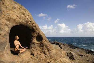
Call for Contributions for Geography Week Photo Exhibit
 |
| Sample Photo |
Geobiography: Geography and Filipino Geographers
February 26 – March 1, 2013
2nd Floor AS Lobby
In line with the Department’s
celebration of Geography Week on February 26 to March 1, and its 30th
anniversary in November, this year’s celebration theme focuses on the connection
between the construction of the self as a Filipino geographer and the spaces
that actively shaped this identity. The photo exhibit will highlight Filipino
geographers’ personal insights, experiences, memories and milestones, along
with the places that have been important to their practice of Geography. These
ideas inspired the Department to put up a photo exhibit that showcases the
various engagements of Filipino geographers in research, the promotion of
geography to the public, extension services and community work in different
locations.
We would like to invite you to take part in
the activity by sharing with us a photograph of you practicing geography in an
interesting and compelling setting, along with a short narrative that will
serve as caption. Approved contributions will be enlarged and printed on a
13”x19” (A3) photo paper which will be showcased in the Geography Week exhibit at
the 2nd floor AS lobby. After the week-long celebration, the exhibit
will be available for viewing at the 4th floor lobby of CSSP Faculty
Center. Due to limited funding, contributors with accepted entries will be
charged a minimal amount of Php230 to cover printing expenses.
Guidelines for the submission of photos are
as follows:
PHOTO FORMAT
- Landscape high-resolution photo (at least 1mb)
- As this is a Geobiography, geographer/s must be in the photo (see sample)
- To give emphasis on the landscape, the geographer must only constitute at most 1/6 of the photo (1/3 for group pictures)
- Photos must be original.
- Photos that were manufactured using Photoshop and other similar applications will not be accepted.
- Only some elements of the photos can be enhanced (i.e. brightness, contrast, hue, etc)
CAPTION
- Must be in English and written in first person point of view
- Maximum of 200 words
- Answers the following questions:
- How has the place shaped you into the geographer you are today?
- What are your academic and/or personal learnings that can be gleaned from the picture?
- How did you contribute to the enrichment of knowledge about the place?
- Email your photos and narratives to Pryor Placino (paplacino@gmail.com) AND David Garcia (davidjonathangarcia@yahoo.com) on or before March 11, 2013.
- Include the following details: complete name of contributor, job/position, affiliation, age, place and date the photo was taken.
SAMPLE PHOTOS


SOURCES:
- http://www.southfrance.com/langphotos/body-landscape2188855_blog.jpg
- http://www.colourbox.com/preview/1239924-774038-group-of-teenage-friends-sledging-in-snowy-landscape.jpg
- http://www.airoots.org/wp-content/uploads/2009/01/dharavishimokita-matiasechanove-600x584.jpg
- http://www.urbanphoto.net/blog/wp-content/uploads/2008/02/delhi2.jpg
- http://api.ning.com/files/TgkDotnqJEjtKH5SS4ugH1S0E-qgnSASzS3gf-JwN*L-KzTE4YZF61*EfEJcs8IIKQxXuz1qZiVm7jatlH-LPv5pEoEvIloT/IMG2012033103279.jpg
- http://www.oxfamblogs.org/fp2p/wp-content/uploads/Lucknow-slum-meeting-300x225.jpg
Subscribe to:
Posts (Atom)