Is the inclusion of diverse local knowledges a guarantee that there will be shared stewardship of the community? Can community mapping help redefine social cohesion in relation to risk and disaster?
Figure 1: A panoramic view of Sabang shoreline (photo: D. Gutierrez)
When the Participatory 3D Mapping (P3DM) was introduced by the UP Department of Geography through the Geography 192 (Field Methods) class to Barangay Sabang in Caluya Island, Province of Antique, the response from the community was immediate and enthusiastic. P3DM has the potential to be transformative in translating the knowledge systems of the community into something materially concrete where the community themselves can take an active role in updating the 3D map based on shifting demographics and environmental changes.
Figure 2: 3D topographical model of Barangay Sabang (photo: E. Garcia)
Taking place from July 16-18, 2025 and with close coordination with the Caluya Municipal Disaster Risk Reduction Management Office (MDRRMO) and Municipal Planning and Development Office (MPDO), a 3D model of Barangay Sabang was co-created by community participants with the assistance of the Geog 192 class under the supervision of three UP Geography professors. Mapping and plotting households were undertaken along with identified vulnerabilities and locally-derived capacities. The 3-day activity not only identified the hazards specific to the area but also conducted a risk assessment of the community.
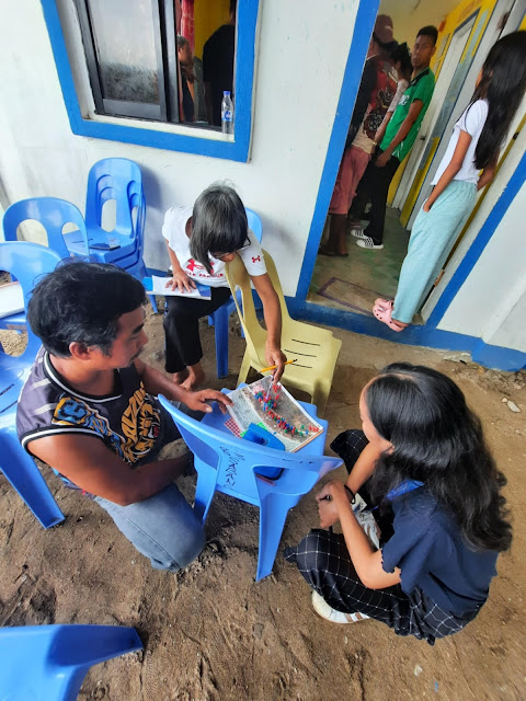
Figure 3A: Community at work in assembling the 3D map (photo: V.A. Imperial)
Figure 3B: A barangay health worker and a kagawad consult with Jia Garcia in assembling the 3D map (photo: D. Gutierrez)
Like most community endeavors that place premium on local knowledge, capacity-building, and giving agency to the community to undertake their own plans mindful of the barangay’s vulnerabilities and capacities, P3DM allows them to take an active role in assessing and planning their mitigation strategies in the event of a disaster.
Figure 4: The community participants, members of the LGU, and the UP Department of Geography posed in front of the completed 3D map (photo: V.A. Imperial).
So to respond to the question posed above, local knowledges alone will not guarantee successful stewardship of the environment, it is in the empowerment of local decision-making that the community’s sustainable futures can be achieved.
Acknowledgements: MPDO head Carlo Caballero, EnP; MDRRMO head Juniffer Ysug; Sabang barangay captain Joel Alvarez; Geography 192 field class students Stephen Gaius Buenaventura, Juvirn Mae Garcia, Vinz Angelo Imperial, Florence Mikhail Dale Lazarte, Christian Mark Lobo, Glendale Lovitos, Hannah Sophia Melendrez, Knisha Ysabelle Payuran, Jose Antonio Miguel Santisteban, Justine Ravert Tan, Luis Miguel Teran, Ureil Rey Toledo; and the UP Geography professors Emmanuel Garcia, EnP (team leader), Darlene Gutierrez PhD, Joseph Palis PhD.


No comments:
Post a Comment